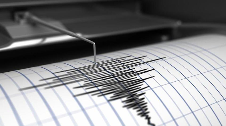
Mgn 3 quake strikes southern Armenia
On July 24, at 21:55 local time (GMT 17:55), the Seismic Protection Survey Seismological Network of Armenia’s Ministry of Emergency Situations (MES) registered a 3 magnitude earthquake at northern latitude 39.690° and eastern longitude 45.390° geographic coordinates – 6km west of Armenia’s Vayk town – at the depth of 10 km.
As Panorama.am was informed from the ministry, the tremor measured magnitude 4 points at the epicenter.
According to initial data, the earthquake was felt in Yeghegis, Artabuynk and Horbategh villages and the town of Yeghegnadzor of Armenia’s Vayots Dzor Province with magnitude 2-3 points.
Տեքստում սխալ կամ վրիպակ նկատելու դեպքում, ուղարկեք խմբագրին հաղորդագրություն` նշելով տվյալ սխալը, այնուհետև սեղմելով Ctrl-Enter:
Newsfeed
11:00
Blinken urges Aliyev to release those unjustly detained in Azerbaijan
U.S. Secretary of State Antony Blinken spoke by phone with Azerbaijani President Ilham Aliyev on Sunday.
Blinken commended Aliyev for...
Source Panorama.am
17:05
Yerevan.Today: Contract soldiers serving on border quit Armenian military
A group of contract servicemen serving on the border with Azerbaijan in Armenia’s Tavush Province are quitting the Armenian army amid...
Source Panorama.am
16:36
Archbishop blames Pashinyan for clashes at protest in border village
Archbishop Bagrat Galstanyan, Primate of the Tavush Diocese of the Armenian Apostolic Church, blamed Prime Minister Nikol Pashinyan and his...
Source Panorama.am
15:57
Temperatures to rise further in Armenia
Rainless weather is expected in Armenia's provinces over the weekend and on Monday.
Showers and thunderstorms coupled with strong winds...
Source Panorama.am
15:46
Reps. Titus and Bilirakis lead legislation to sanction Azerbaijani war criminals
Representatives Dina Titus (D-NV) and Gus Bilirakis (R-FL) have introduced bipartisan legislation that seeks to enforce sanctions against...
Source Panorama.am
15:16
Opposition MP defends servicemen's meeting with protesters in Tavush
MP Tigran Abrahamyan, who represents the opposition Pativ Unem faction, has defended contract servicemen’s move to meet with protesters in...
Source Panorama.am
14:35
Kremlin: Moscow supports continued talks between Yerevan, Baku
Russia supports continued negotiations between Yerevan and Baku for the settlement of all outstanding issues, Kremlin spokesman Dmitry...
Source Panorama.am
14:04
Japan blocks Mount Fuji view to curb tourist misbehavior
A Japanese town is blocking off its panoramic views of Mount Fuji to tackle unruly behaviour by tourists who have been flocking to take pictures...
Source Panorama.am
13:36
Expert urges efforts to prevent Azeri control of gas pipeline in Armenia's Tavush
Varuzhan Geghamyan, a Yerevan-based geopolitical strategist and regional security expert, says Armenian officials’ statements on the...
Source Panorama.am
13:05
Danish delegation joins EU mission for patrol in Goris
The Danish Deployment Facility for Peace and Democracy (DFPD) delegation has joined the EU monitoring mission in Armenia for a patrol in...
Source Panorama.am
12:33
Authorities probing involvement of servicemen in Tavush protests
The Armenian Investigative Committee is probing reports of the involvement of contract soldiers in ongoing protests in Tavush Province against...
Source Panorama.am
11:34
Senator Peter Welch commemorates Armenian Genocide
Senator Peter Welch has commemorated the 109th anniversary of the Armenian Genocide.
“From 1915-1918, hundreds of thousands were...
Source Panorama.am
11:15
King Charles to resume public duties next week
King Charles III is back.
The 75-year-old monarch will resume some public duties next week following a three-month break to focus on his...
Source Panorama.am
11:00
Contract soldiers join protests in Armenia's Tavush
Around 20 contract soldiers joined ongoing protests against unilateral territorial concessions to Azerbaijan in Armenia’s Tavush...
Source Panorama.am
17:25
Pashinyan urged to stop 'unconstitutional' border delimitation
Fair Armenia party chairman Norayr Norikyan and its members gathered outside the Armenian government building on Friday to warn against the land...
Source Panorama.am
17:06
Police clash with protesters on major Armenian highway
Riot police on Friday clashed with protesters blocking the Yerevan-Sevan highway in Armenia in protest against territorial concessions to...
Source Panorama.am
16:31
ARARAT Armenian Brandy is official partner of Armenian pavilion at 60th Venice Biennale
One of the most significant contemporary art cultural events, the 60th Venice Art Biennale, is taking place in Venice. During the event, ARARAT...
Source Panorama.am
16:16
Scholz: Chances for Yerevan-Baku conflict settlement higher than ever
The chances for a peaceful settlement of the conflict between Armenia and Azerbaijan are higher than ever before, German Chancellor Olaf Scholz...
Source Panorama.am
15:45
Ex-Armenian president discharged from hospital
First Armenian President Levon Ter-Petrosyan was discharged from a hospital in Yerevan on Friday after undergoing a routine checkup, his...
Source Panorama.am
15:26
Opposition MP: Azerbaijan seeks control over strategic areas
Azerbaijan seeks to gain control over strategic areas as a result of the border delimitation and demarcation with Armenia, claims opposition...
Source Panorama.am
14:36
Police say no road blockages in Yerevan
No roads were blocked in Yerevan as of 1 p.m. Friday, the police reported.
Also, traffic along the Yerevan-Echmiadzin highway has bee...
Source Panorama.am
14:15
Christian leaders urge UK government to recognize Armenian Genocide
Bishop Hovakim Manukyan, Primate of the Armenian Church in the UK, and a host of British church leaders and members of the House of Lords sent a...
Source Panorama.am
13:46
Armenian court refuses to release jailed election winner
Armenia’s Anti-Corruption Court has denied a defense motion to release political prisoner Mamikon Aslanyan, a former mayor of...
Source Panorama.am
13:28
'No comment': Pashinyan's wife travels to Gyumri by train
A secretly filmed video of Armenian Prime Minister Nikol Pashinyan's spouse, Anna Hakobyan, travelling from Yerevan to Gyumri by train has...
Source Panorama.am
13:05
Protests against land handover to Azerbaijan continue in Armenia
Acts of civil disobedience against territorial concessions to Azerbaijan continued in Yerevan and other parts of Armenia on Friday....
Source Panorama.am
12:35
No exact date yet for meeting of Armenian, Azeri FMs
Armenia and Azerbaijan are yet to agree on the exact date for a meeting between their foreign ministers in Kazakhstan, the Armenian Foreign...
Source Panorama.am
12:05
Activists in Yerevan campaign against land handover to Azerbaijan
Activists in Yerevan held a spontaneous awareness campaign focusing on the handover of border areas in Armenia’s Tavush Province...
Source Panorama.am
11:36
Senior security official warns of rising tensions on Belarus' western border
The situation on Belarus’ western border is getting increasingly tense and explosive due to the West’s actions, Pavel Muraveiko,...
Source Panorama.am
11:28
Armenian boxer beats rival from Azerbaijan to reach European C'ships finals
Armenian boxer Narek Manasyan has successfully made it to the finals of the EUBC European Boxing Championships 2024 in Belgrade, Serbia.
The...
Source Panorama.am
11:00
Ruben Vardanyan ends hunger strike in Baku prison, family says
Family members confirmed on Thursday that thanks to the growing international public and government awareness, illegally detained...
Source Panorama.am


Videos
17:32 20/02/2023
Artur Vanetsyan: I think you'll see me more often at various events in future

17:35 20/02/2023
Armenian expert: U.S. stance on Karabakh remains unchanged


13:59 09/02/2023
Premature births increase in Artsakh due to stress

12:43 09/01/2023
Snow-covered Yerevan

15:41 15/12/2022
Gegham Stepanyan calls for sanctions against criminal Azerbaijan


11:45 29/11/2022
Memorial plaque honoring Yeghishe Charents inaugurated in Yerevan